List Price: $900,000 | 128.84 Acres | Price Per Acre $0 Land
on Upper Baker Pond Listed Friday Jul 26, 2024 | MLS# 5006913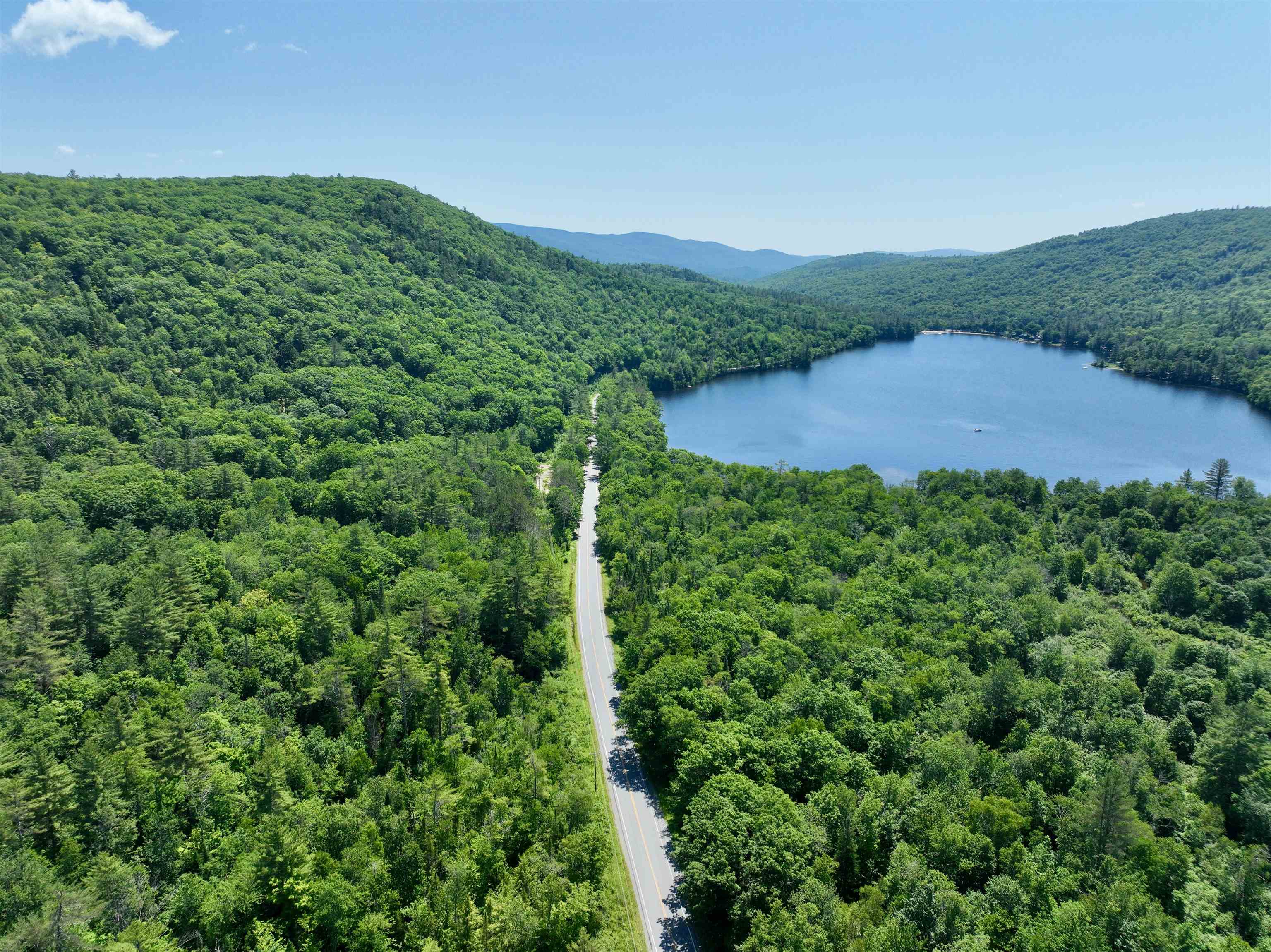
Approaching Property Summit - overlooking Lower Baker Pond

View of Trout Pond, Orchard and Carriage House at roadside

Carriage House and very early stonewall along Cape Moonshine Road

Upper level entry of Carriage House

Fire Pit and seating overlooking Trout Pond

Another view of Pond

Orchard View from Carriage House lower level

Road follows stonewall

One more of many roads

Edge of Oak Grove producing acorns for wildlife.

One of two spring fed water holes for wildlife.

Corduroy road

Another road.

Another edge of Oak Grove.

One of many springs surfacing.

One of many hiking trails between roads.

2.5 acre Residence Lot in Blueberry Field

3 Acre Homestead, Trout Pond, Carriage House, and Blueberry Lot and Field
Create your perfect world on these amazing 128+ acres conserved with the Upper Valley Land Trust; 51.51 acres of which are in Orford. The 7.40 acre building site at the summit commands a 360 degree view from a massive promontory looking 600 feet down on both Baker Ponds. Here is the opportunity to build a net zero energy residence with wind and solar electricity generation and geothermal heating and cooling system and battery backup installation. Part of original land grant to Governor Wentworth from the King of England in 1766, this unspoiled parcel is very near the Appalachian Trail and has three miles of roads and trails for hiking, driving, mountain biking, downhill, backcountry and cross country skiing, and snowshoeing. There is a spring fed, 20 foot deep trout pond, all-year brook, several all-year springs and small ponds. Wild fruits abound, including raspberries, blueberries, and blackberries, as well as apples, ramps and six edible mushroom species. It is a habitat for black bear, moose, white-tail deer, snowshoe hare, coyote, ermine, wild turkey, woodcock, fisher, bobcat and multitudes of migrating birds. Timber in the Forestry Management Plan is due for harvest. There is a 1785 carriage house/studio on Cape Moonshine Road at the existing entrance. 2.5 hours to Boston. 45 minutes to Hanover. Committed buyer of this property has the option to purchase the 3 acre Homestead Property with 1785 house and/or the 2.5 acre undeveloped lot in the Blueberry Field.
Lot Description: Abuts Conservation | Adjoins St/Nat'l Forest | Near Snowmobile Trails | Rural | Conserved Land | Country Setting | Mountain View | Pond | Recreational | Rolling | Secluded | Sloping | Steep | Timber | Trail/Near Trail | View | Walking Trails | Wooded | Near ATV Trail
Sale Includes : Building
Lot Size: 128.84 acres
Zoned: None)
Surveyed: Yes
SurveyedBy: Barnard Survey
Flood Zone: No
Zoned: None)
Surveyed: Yes
SurveyedBy: Barnard Survey
Flood Zone: No
Land Services
Roads: Other | Easement
Road Frontage: 1567
Electric: None
Water: Dug Well
Sewer: None
Roads: Other | Easement
Road Frontage: 1567
Electric: None
Water: Dug Well
Sewer: None
Land Restrictions : Easement/ROW | Elevation | Wetland
Docs Available : Deed | Plat/Grid Map | Property Disclosure | Right-Of-Way (ROW) | Survey
Easement - Yes
ROW Length: 281 ft
ROW Width: 60 ft
Block - 000
Taxes $0
Assesed Value Not Reported
Schools
School District: Wentworth
Elementary School: Wentworth Elementary
High School: Plymouth Regional High School
School District: Wentworth
Elementary School: Wentworth Elementary
High School: Plymouth Regional High School
PLEASE NOTE: Both New Hampshire and Vermont law require brokers and agents to disclose at the “time of first business meeting, prior to any discussion
of confidential information”, in New Hampshire’s case, and “first reasonable opportunity”, in Vermont’s case, the
nature of the relationships brokers have or may have with customers and clients. Each state requires that a disclosure form be presented to
consumers for their review and acknowledgment at the appropriate time. These forms can be accessed here:
VT: VERMONT REAL ESTATE COMMISSION MANDATORY CONSUMER DISCLOSURE FORM
NH: NEW HAMPSHIRE REAL ESTATE COMMISSION BROKERAGE RELATIONSHIP DISCLOSURE FORM